Case Studies
SolaRoad Bike Lane
Krommenie, The Netherlands
categories
benefits
beautify streetscape, 
build community, 
improve environment, 
reduce health disparities, 
slow traffic, 

Background

 Image of SolaRoad Source: ©TNO 2011

SolaRoad, a road covered with energy-generating solar panels, is scheduled to be installed on several miles of bicycle path in the town of Krommenie in northern Holland in 2012. TNO, a Dutch company who developed the SolaRoad, is working with the Province of North Holland, the consulting firm Ooms Averhorn Group, and the technology firm Intech, on this pilot program, hoping to expand the project throughout the country after a 5-year testing period.

 Image of SolaRoad Source: ©TNO 2011

SolaRoad consists of concrete panels (1.5 by 2.5 meters) with embedded thick crystal silicon solar cells, covered by a toughened glass surface. The smart ICT applications will maximize energy retention during peak sunlight times and efficiently store it during low-light periods. The energy produced from the road will be used to power streetlights, stoplights, and household appliances. It is estimated that the Dutch road network is comprised of 85,000 miles of roadway with the potential for generating 54 kWh per square yard. The pilot study will determine how the energy will be used and how smart ICT applications can enable the energy produced in peak sunlight periods to be distributed as efficiently as possible during the periods of little or no light.

A solar-powered roadway Source: Solar Roadways

Proposed US Solar Roadway

A solar-powered roadway is an idea of Scott Brusaw, a 53-year-old electrical engineer in tiny Sagle, Idaho. It is made from super-strong glass, instead of conventional asphalt or concrete. Solar cells inside its glass surface allow the roadway to act as a solar power generator. Electricity generated by the highway could be used to recharge electric vehicles and to power lights and LED warning signs along the road itself (Ligget 2010).

Solar Powered Road Studs, UK

Solar powered road studs automatically illuminates from dusk to dawn with its built in solar-powered light-emitting diode (LED). The studs deliver greater visibility of the road layout ahead, and thus have reduced road accidents by over 70% at their UK installation sites (Astucia).

Lessons Learned
Potential Benefits:

  • Generates sustainable electricity.
  • Minimizes the need for space for electricity generation and transmission.
  • Reduces carbon dioxide emissions.
  • Can be applied to bicycle paths, arterial roads, or highways to generate energy.

Potential Issues:

  • Under development: Engineering, material selection, energy distribution, (social) business model and user criteria (safety, comfort) are still in the process of development. The pilot study began with a bicycle path because there are fewer traffic needs and requirements.
  • Needed criteria: More criteria are needed for stiffness and maintenance (TNO).
  • Cost: SolaRoad is profitable in 5-8 years in the Netherlands and in 4-5 years in southern Europe.

Sources

Astucia. “SolarLite Embedded Flush Studs” (http://www.astucia.co.uk/products/product-details?categoryid=176892&productid=176893)

Cardoni, Salvatore, 2011. “Coming to Krommenie, Holland: Solar-Paneled Bicycle Paths” (http://www.takepart.com/article/2011/01/31/coming-krommenie-holland-solar-paneled-bicycle-paths)

Davies, Alex, 2011. “Dutch To Build Solar Panels Into Their Roads, Starting With Bike Lanes.”

Liggett, Britt, 2010. “Energy Generating, Self-Heating Solar Roadway Unveiled” (http://inhabitat.com/energy-generating-self-heating-solar-roadway-unveiled/)

TNO. “SolaRoad Combines Road and Solar Cells” (http://www.tno.nl/content.cfm?context=thema&content=inno_case&laag1=895&laag2=912&item_id=1234&Taal=2)

Treehugger (http://www.treehugger.com/clean-technology/dutch-to-build-solar-panels-into-their-roads-starting-with-bike-lanes.html)

Photo Sources

MIG, Inc.

Case Studies
Solar Roadway
Waarland, The Netherlands
categories
benefits
beautify streetscape, 
build community, 
improve environment, 
slow traffic, 

Background

Winter and summer application Source: Ooms Avenhorn Groep

Road Energy Systems ® is a solar-heat-storing asphalt developed by Ooms Avenhorn Holding BV,a Dutch company. The stored solar energy can be used for many purposes, such as heating and cooling buildings and homes. Water is run through pipes under the asphalt and heated from the warmth of the road. This heated water is then pumped underground and stays warm at 68 degrees F. The water can be sent to nearby houses, and this water can be pulled up to prevent ice from building up on the road during winter months. Moreover, carbon dioxide emissions from using fossil fuels are reduced.

RES construction Source: Ooms Avenhorn Groep

A test demonstrated the great potential of this technology. One test patch—200 yards of road and a small parking lot— generated enough heat for 70 apartments in a four-story building. This occurred under the typical cloudy Dutch weather with only a few days a year of sweltering temperatures (Blanco 2008).

In Waarland, Netherlands, the Road Energy Systems ® (RES) was combined with a d'Waert housing project in 2009. Thirty-five houses use the heating and cooling system generated by the RES collector. This collector also serves as an energy supplier for the entire neighborhood (De Peyler).

RES construction Source: De Peyler

Lesson Learned
Potential Benefits:

  • Provides economic and environmental benefits in the neighborhood.
  • Generates clean electricity, eliminating the need for fossil fuels and preventing global climate change.
  • Eliminates energy losses and transmission costs.
  • Increases the durability of roads since the temperature-regulated pavements prevent rutting damage (Patterson 2011).

Houses using RES Source: De Peyler

Potential Issues:

  • Upfront cost: The pipes and solar road system double the cost of building the road, but payoff can be expected within 5-6 years (TNO 2011).
  • Surface maintenance: There is concern about the system’s ability to support the weight and wear and tear of asphalt.
  • Bumper-to-bumper traffic: Energy collection effectiveness is unknown in bumper-to-bumper traffic conditions.
  • Financial and political barriers: The lack of revenue sources result in reluctance of federal and state government support (Patterson 2011).

Sources

De Peyler. “Bike Path as an Energy Supplier” (http://www.depeyler.nl/nl/5/335/road_energy_systems.aspx)

Ooms Avenhorn Groep (http://www.ooms.nl/)

Blanco, Sebastian, 2008. “In Future, the Road Heats You - Solar Energy Stored in Asphalt” (http://green.autoblog.com/2008/01/05/in-future-the-road-heats-you-solar-energy-stored-in-asphalt)

Patterson, Thom, 2011. “Solar-powered 'Smart' Roads Could Zap Snow, Ice” CNNTech. (http://www.cnn.com/2011/TECH/innovation/01/19/smart.roads/index.html)

TNO, 2011. SolaRoad Presentation. (http://www.tno.nl/downloads/Presentation%20SolaRoad%20definitief_uk.pdf)

Photo Sources

MIG, Inc.

Case Studies
Portland Green Street Program
Portland, OR
categories
benefits
beautify streetscape, 
build community, 
improve environment, 
reduce health disparities, 
slow traffic, 

Background

 Green Streets Tour Map Source: City of Portland

Portland is a leader in using strategies that manage storm water runoff, enhance community and neighborhood livability, and strengthen the local economy. A street that uses vegetated facilities to manage storm water runoff at its source is referred to as a Green Street. A Green Street is a sustainable storm water strategy that meets regulatory compliance and resource protection goals by using a natural systems approach to manage storm water, reduce flows, improve water quality and enhance watershed health.

In April 2007, the Portland City Council approved a Green Street resolution, report, and policy to promote and incorporate the use of Green Street facilities in public and private development.

A green street retrofit which manages stormwater at the source through a vegetated swale, while enhancing the neighborhood Source: Google Street View 2012

The council recognizes that a comprehensive Green Street approach is an important development strategy to:

  • Reduce polluted storm water entering Portland’s rivers and streams.
  • Improve pedestrian and bicycle safety.
  • Divert storm water from the sewer system and reduce basement flooding, sewer backups and combined sewer overflows (CSOs) to the Willamette River.
  • Reduce impervious surface so storm water can infiltrate to recharge groundwater and surface water.
  • Increase urban green space.
  • Improve air quality and reduce air temperatures.
  • Reduce demand on the city’s sewer collection system and the cost of constructing expensive pipe systems.
  • Address requirements of federal and state regulations to protect public health and to restore and protect watershed health.
  • Increase opportunities for industry professionals.

Adopted from: Portland Green Street Program

Shady Woodland: An informally arranged planting design using native and ornamental plants Source: City of Portland

A critical piece of the City’s pioneering effort on green streets is public education. The City uses signage, tours, art displays, workshops, meetings, newsletters, fact sheets, fun outreach tools and events, and school lessons and tours. The city also encourages private participation in the development and implementation of the Green Street solutions.

Green Street Guiding Principles

  1. Manage storm water runoff both at the source and the surface.
  2. Use plants and soil to slow, filter, cleanse, and infiltrate runoff.
  3. Design facilities that aesthetically enhance the community.

Types of Green Streets

 Grasses: A massed planting design that emphasizes the fine textures, year round structure and color variation of grasses Source: City of Portland

  • Storm water curb extension: Extending into the street, storm water curb extensions transform the curb lane into a landscape area. Curb extensions can conveniently integrate a ramp for safe pedestrian crossing.
  • Storm water street planter: Storm water street planters between the sidewalk and the curb work well in areas with limited space, and they allow for adjacent street parking or travel.
  • Rain gardens: Where there is plenty of space, rain gardens are ideal. They can also transform awkward street intersections into safe pedestrian and bicycle crossings.
  • Simple Green Street: Excavating an existing planting area behind a reinforced curb, making curb cuts for inflow and outflow, and landscaping with appropriate vegetation is a simple approach to capture and treat street runoff.
  • Green Streets tour: Green Streets are implemented all around the city. The illustration below show detail plans (City of Portland).
  1. Portland State University street planters: Managing storm water runoff from the street through vegetated planters for flow and water quality benefit.
  2. NE 35th Place and Siskiyou Street curb extension swales: A green street retrofiw, which manages storm water at the source through a vegetated swale, while enhancing the neighborhood.
  3. NE 313st Avenue and Fremont Street landscaped curb extension: This argay Neighborhood site was retrofitted with a curb extension to manage street runoff.
  4. Glencoe Elementary School rain garden: BES and Portland Public Schools worked in partnership on this project.
  5. SE Division Street New Seasons Market: Landscape planters in sidewalk area take street runoff while beautifying a commercial/retail zone.
  6. Westmoreland permeable pavement project:
  7. N Gay Avenue porous pavement pilot project: pervious asphalt

Planting Design Guidelines (Text and photos from City of Portland):

  • Grasses: A massed planting design that emphasizes the fine textures, year-round structure and color variation of grasses. The deciduous trees and shrubs add more fall color (e.g., California Grey Rush, Dwarf Redtwig Dogwood, Creeping Bramble, Orange Sedge).
  • Shady woodland: An informally arranged planting design using native and ornamental plants (e.g., California Grey Rush, Blue Oat Grass, Boxleaf Euonymus, Sword Fern, Creeping Oregon Grape, Daffodil).
  • Blooming garden: For a more formal, manicured neighborhood setting. The plants are tidy and compact with an emphasis on year-round flower and foliage color. Full sun (e.g., California Grey Rush, Heavenly Bamboo, Little Rascal Holly, Magic Carpet Spirea).
  • Full gold garden: A design that emphasizes year-round structure and color variation of grasses, with a splash of pink flowers in summer. The deciduous trees add fall color. Full sun to partial shade (e.g., California Grey Rush, Gold Fountains Sedge, Gold Flame Spirea).
  • Single species: Narrow, flat-bottom facilities are planted with a single species due to limited space. This creates year-round interest with a bold, simple design of color and texture (e.g., Ice Dance Sedge, Gold Fountains Sedge, California Grey Rush, Slough Sedge, Orange Sedge).
  • Adpoted from: City of Portland
    For more information visit: Green Streets
    (http://www.portlandonline.com/bes/index.cfm?c=34602&)

    Planting Approach

    • Do not plant where vegetation will impede flow into the facility. For example, do not plant directly in front of curb openings, and take care when planting next to the edges where runoff sheet flows into the facility. Consider growth and spread of groundcover over time to reduce potential of blocking inlets.
    • Dense plantings at the time of construction are recommended to:
      • Provide immediate facility function, e.g. slow and detain storm water flow. trap sediments, and infiltrate storm water.
      • Reduce soil erosion.
      • Limit weed growth.
      • Shade the soil and reduce evaporation.
    • Planting a row of juncus species behind the forebay can reduce the migration of sediment into the facility.
    • Avoid planting in summer months to reduce transplant shock and excessive irrigation. Plant in fall or early spring after frost.

    Maintenance

    The type and frequency of short-term start up and long-term maintenance can affect plant vigor, growth habit, and facility aesthetics.

    • New facilities will require more frequent maintenance to ensure plant vigor in the first two years after planting. Activities include regular irrigation during dry summer months, controlling weeds before they become established, debris removal, and occasional mulching.
    • Overhead spray irrigation systems can encourage weed growth, given the right conditions, by wetting the entire area. Drip irrigation systems appear to be better alternatives to control water delivery directly to the selected plant.
    • Concentrated sediment deposits, especially from street runoff, should be removed frequently so as not to create conditions that support germination of non-native or undesirable species and so deposits do not smother healthy plants. Frequency will depend on each site.
    • Depending on the selection of plants and the particular constraints of a facility site, large rambling shrubs may require regular pruning or shearing to control their height and spread. This practice can increase vegetative growth.

    Adopted from: 2007 Vegetation Survey Report for Landscaped Storm water Management Facilities, City of Portland

    Lessons Learned

    Potential Benefits

    • Provides clean air and water.
    • Enhances neighborhood livability.
    • Increases community and property values.
    • Enhances pedestrian and bicycle access and safety.
    • Protects valuable surface and groundwater resources.
    • Adds urban green space and wildlife habitat.
    • Helps meet regulatory requirements for pollutant reduction and watershed resource management.
    • Reduces storm water in the sewer system.
    • Saves money on wastewater pumping and treatment costs.
    • Demonstrates that Green Streets can be applied to residential streets, commercial zones, school zones, and parking areas.

    Potential Issues

    • Parking: Depending on the type of facility, parking space can be removed (e.g. curb extensions).
    • Mosquitoes: Green Streets are designed to drain in less than 48 hours to prevent mosquito breeding, but continuous monitoring is necessary.
    • Plant survival: Attention should be given to site characteristics, such as location, solar exposure, and soil type and condition, to provide optimum success for plant survival. To increase survival rates, vegetated facilities must receive proper and consistent irrigation and weed control, especially during the first two years of establishment.
    • City codes: City codes can prohibit use of ornamentals in some areas, such as environmental and greenway zones. Even if native species require little irrigation and no pesticides or fertilizer, native species alone can limit plant diversity.
    • Maintenance: The city needs to regularly monitor facilities. In Portland, Environmental Services maintains Green Streets. Also neighbors’ help is essential to keep the facilities free of litter and leaves.

    Adopted from : City of Portland Q&A: http://www.portlandonline.com/bes/index.cfm?c=45379&a=212485, and 2007 Vegetation Survey Report for Landscaped Storm water Management Facilities

    Sources

    City of Portland, “Portland Green Street Program” (http://www.portlandonline.com/BES/index.cfm?c=44407)

    City of Portland, “2007 Vegetation Survey Report for Landscaped Storm water Management Facilities”

    City of Portland, “Green Streets” (http://www.portlandonline.com/bes/index.cfm?c=34602&)

    City of Portland, “Q&A” (http://www.portlandonline.com/bes/index.cfm?c=45379&a=212485)

    Photo Sources

    MIG, Inc.

Case Studies
Deaderick Street
Nashville, TN
categories
benefits
beautify streetscape, 
improve environment, 
reuse underutilized land, 
slow traffic, 

Background

Deaderick Street is an urban core streetthat serves as a physical connector between the city/county courthouse and the state legislature. This street was a central transfer point for the Metro bus system. It was filled with empty bus shelters, had no trees, and had a storm water and sewage overflow problem. However, the street was transformed into one of the most sustainable and livable streets in the downtown area in 2009, one year after the city decided to relocate the bus system’s hub one block. Now the streetscape has 102 trees, 4,249 shrubs and perennials and all LED lights.

Deaderick Street Source: Google Maps, 2012

Adopted from: Jenny Burns 2009, Nashville Business Journal

Hawkins Partners, Inc., worked with the Office of the Mayor and Metro Public Works to transform the historically and civically significant corridor. Deaderick Street is situated within the Kerrigan Basin, one of Nashville’s Combined Storm Sewer basins, where had overflow problems. The project primarily focused on addressing storm water issues and urban trees. Based on Nashville’s historical rainfall patterns, infiltration rates and variable design factors, it is estimated that over 1.2 million gallons will be removed from the CSO system on an annual basis through this three block urban street (Hawkins).

Deaderick Street Source: Google Maps, 2012

Adopted from: Jenny Burns 2009, Nashville Business Journal

Project Highlights
Who: Metro Nashville Public Works
When: October 2008 to October 2009
General contractor: Roy T. Goodwin Contractors, Nashville, TN
Landscape architect: Hawkins Partners Inc., Nashville, TN
Project budget: Under $5 million ($3.1 million in capital improvement funds)

  • Provided a 700% increase in pervious area (diverting approximately 1.2 million gallons of storm water from the Cumberland River per year).
  • Incorporated bioswales (Rain gardens) at sidewalk level planting areas and at street level to capture, filter and infiltrate rainwater.
  • Used porous concrete used to allow water infiltration through sidewalk to tree root zones.
  • Planted 102 4-inch caliper shade trees, and 4249 shrubs, perennials, sedges, and groundcover plants.
    • Native plants comprise 53% of the species installed.
    • Some healthy, existing street trees were transplanted.
  • Other elements included:
    • Irrigation: low flow nozzles (33% less water), drip system and soil moisture probe.
    • Pedestrian streetlights and guidance signs are LED.
    • LED traffic signals.
    • Solar-powered parking meters.
    • Recycled, crushed concrete used for sub-base for concrete walks.
    • High percentage recycled steel used in pedestrian light poles, tree grates, fence, trash/recycling containers, pedestrian guidance signs.
    • Recycled coal fly ash within the concrete.
    • Bicycle storage facilities.
    • Educational kiosks that explain the benefits of urban trees, rain gardens, and sustainable infrastructure.

Adopted from: City of Nashville (http://www.nashville.gov/pw/pdfs/projects/DeaderickStreetscapeImprove.pdf)

Deaderick Street Source: Google Maps, 2012

This plan also focused on creating a multipurpose environment that would draw people in. The long-term master plan proposed additional development potential of 40,000 square feet of retail and restaurant uses, 11,000 square feet of office use, and 94 residential housing units. The street can be a venue for occasional events and festivals. The removal of the transit mall reduced average daily traffic volume, creating a more pedestrian-friendly environment and providing more on-street parking. Yet, business owners share differing opinions. There is an increase in tourists with concerts and other events to the street. But some owners said business was better when the bus transit center was there.

Adopted from: Elizabeth Johnson, The Tennessean

Potential Benefits:

  • Promotes sustainable and livable streets through low-impact design.
  • Generates less traffic and thus more pedestrian-friendly environment.
  • Brings tourism money to the downtown area through events and festivals.
  • Prevents water sewage problems.
  • Implements the plan block-by-block to allow as much of the street as possible to remain open during construction.
  • Serves as one of four Tennessee projects to be accepted as pilot projects for The Sustainable Sites Initiative (Johnson 2010).

Potential Issues:

  • Business impact: The relocation of the transit center had a negative impact on businesses in the area.
  • Code and regulation amendments: Amendments may be required to allow more street activities like outdoor dining (Hawkins).

Sources

Burns, Jenny, 2009. “Deaderick Hailed as State's First 'Green Street',” Nashville Business Journal (http://www.bizjournals.com/nashville/stories/2009/10/05/daily27.html).

Green Infrastructure Digest. “Deaderick Street Discussed at StormCon 2010” (http://hpigreen.com/tag/deaderick-street/)

Hawkins, Kim. “Nashville Creates Tennessee's First ‘Green’ Street.” Public Works (http://pwmag.com/industry-news.asp?sectionID=760&articleID=1537236&artnum=1)

Johnson, Elizabeth, 2010. “Renovated Deaderick Street Enhances Nashville's City Core,” The Tennessean (http://www.tennessean.com/article/20100615/DAVIDSON/100615071/Renovated-Deaderick-Street-enhances-Nashville-s-city-core)

Nashville. “Deaderick: Tennessee’s First ‘Green Street’” (http://www.nashville.gov/pw/pdfs/projects/DeaderickStreetscapeImprove.pdf)

Photo Sources

MIG, Inc.

Case Studies
Insadong-gil
Seoul, Korea
categories
benefits
beautify streetscape, 
build community, 
improve environment, 
reuse underutilized land, 
slow traffic, 

 Insadong neighborhood. Aerial Source: Google Earth 2012

Insadong-gil is a great example of a shared road that respects its historic past while meeting the changing needs of modern street users. It is a narrow road in Insadong, a historic neighborhood in Jongno-gu District of Seoul in South Korea. The district is bordered by Gwanhundong to the north, Nagwon-dong to the east, and Jongno 2-ga and Jeokseon-dong to the south, and Gongpyeong-dong to the west. The street is only approximately 0.4 miles long and 33 feet to 49 feet wide. Along the street, there are a multitude of antique shops, traditional paper shops, galleries, cafes and restaurants. The three lines of Seoul Metro (subway) and free shuttle buses connect the area to other destinations.

The gateway to Insadong-gil. Source: MIG

The Insadong has a long history. It was originally two towns whose names ended in the syllables "In" and "Sa." They were divided by a stream which ran along Insadong's current main street. It began 500 years ago as an area of residence for government officials. During the Japanese occupation, the wealthy Korean residents were forced to move and sell their belongings. The site became an area for trading in antiques. It was a popular destination among foreign visitors to South Korea during the 1960s, who called the area Mary's Alley. In 1988, it became a historic and cultural street. To keep the traditional Korean feel of Insadong intact, the city allows only certain types of businesses in the area. Most of these older buildings are now used as restaurants or shops. Among the historically significant buildings located in the area are Unhyeongung mansion, Jogyesa, one of the most significant Korean Buddhist temples, and one of Korea’s oldest Presbyterian churches.

The flush curb shared road character of Insadong-gil. Source: Google Street View 2012

From 1999 to 2000, the City redesigned the street as an unique corridor for experiencing history and culture. For the street section north of of Insadong 5-gil, the asphalt pavement was replaced by traditional Korean black tiles. The flush 'curbless' road was maintained by replacing ugly cement roadblocks with elegant granite slabs, thereby demarcating a clear path of travel for automobile. The granite paving for the automobile way is rougher and stands in the contrast with the more polished texture that is primarily used by pedestrians, temporary parking and for loading and unloading services. New trees with planters and additional seating help create comfortable areas for sitting and gathering.

Historic character of Insadong-gil is strengthened with custom street furnishings. Source: MIG

The section south of Insadong 5-gil continues most of the pedestrian friendly features including trees in planters, granite slabs for seating and Korean black tiles for sidewalk paving. However, the automobile way has asphalt surface and separated from the formal sidewalk by a small curb. Most of the street is a one way street open to automobile traffic. The entire street is closed to traffic on Sundays. The two ends of the street are defined by venues for social gathering and performances as well as information centers for tourists. Overall, the street was redesigned to allow for more festivals such as the six day annual Insa festival, that would attract both locals and tourists. To further beautify the neighborhood, old and unsightly utility poles were removed with floral containers. The widened sidewalks, traditional pavement and the narrower vehicle road have made the Insadong-gil more pedestrian-friendly.

Historic character of Insadong-gil is strengthened with custom street furnishings. Source: MIG

One of the key elements that imbues the street with a unique identity is the custom designed signage and seating. The street furnishings celebrate the mix of of historical and modern architecture that can be seen along the street. Wide variety of seating fixtures exist. Engravings in the seating tell stories of the its past historic past. Art is also integrated in the design of gateways, seating, planters and fountains.

Insadong is the place where 40 percent of the nation’s antique shops and galleries as well as 90 percent of the traditional stationary shops are located. This place is also famous for traditional tea and Korean food, which enhance the sensory experience of the locals and tourists. A multitude of street performances by artists makes the street experience memorable. There are daily calligraphy demonstrations and pansori performances of traditional Korean music. This formal and informal programming of street life helps strengthen its ability to remain an identifiable street.

Adopted from: Insadong

Lessons Learned
Potential Benefits:

Pedestrian friendly environment.

  • Creates a pedestrian-friendly environment with the widened sidewalk, narrowed road, lined trees and public seats, providing a pleasant walking experience.
  • Enlarges the pedestrian realm by closing the street to traffic every Sunday.
  • Creates a unique streetscape that provides a sensory experience as well as historic experience of Korea with artistic street performances, galleries, and the antique shops in the historic buildings.

Potential Issues:

  • Restriction on the type of businesses: Even though the city restricts the sprawling of Western chains, the street has become more tourist-oriented, losing its personality because of an excessive number of souvenir shops and other tourist-oriented businesses.
  • Pedestrian traffic: Since the Insadong-gil is one of the most popular streets in Seoul, especially on the weekend, it is difficult to maneuver one’s way through the crowd. Some people may enjoy being in the crowd, but some may find it unpleasant.
  • Shared streets: During the weekdays, the through traffic and illegally parked cars makes the narrow road even busier, disrupting pedestrian flow.

Photo Sources

MIG, Inc.

Case Studies
The Third Street Promenade
Santa Monica, CA
categories
benefits
beautify streetscape, 
build community, 
improve environment, 
slow traffic, 

Background

Third Street Promenade, Source: Google Earth 2012

The Third Street Promenade is one of the few successful pedestrian malls in USA. This grand mixed-use entertainment venue is about 0.4 miles long. Located in Downtown Santa Monica, the three blocks of the Promenade lie between Broadway and Wilshire Boulevard. Due to its proximity to the Pacific Ocean coupled with Los Angeles's mild climate, it has been a popular tourist destination.

There are more than 60 stores as well as 25 restaurants, cafes and casual dining places on the Promenade. Besides great shopping and dining, the area has many entertainment alternatives, such as movie theaters, venues for performances, clubs and bars.

Well designed promenade with a wide mix of uses, Source: MIG

One of the biggest entertainment attractions of the Third Street Promenade is the eclectic mix of street artists and performers. The Downtown Santa Monica Farmers’ Markets is located at the Promenade on Wednesday and Saturday. There are public parking structures on 2nd and 4th Streets between Wilshire Boulevard and Broadway, and one structure just north of Wilshire on 4th Street.

The design of the revitalized Promenade included amenities such as custom designed drinking fountains, Source: MIG

The Third Street Promenade was a typical street with automobile traffic. In1965, the City converted it into a pedestrian mall called the Santa Monica Mall. In 1984, the Santa Monica City Council created a city-funded nonprofit agency called the Third Street Development Corporation, now Downtown Santa Monica, Inc. (DTSM, Inc.), to revitalize the area. With a citywide bond measure issued in 1986, the mall was redesigned and renamed as the Third Street Promenade. A new shopping center, Santa Monica Place, designed by Frank Gehry, was built at the Promenade's southern end. Third Street Promenade opened in 1989, redesigned by the architectural firm ROMA Design Group. The City also created the Third Street Promenade and Downtown District assessment fee. Funded by tenants within the district, it generates approximately $13 million per year for Promenade management.

70' foot wide is primarily pedestrian oriented but allow emergency and service access, Source: MIG

The Third Street Promenade is an approximately 70-foot wide and lined with trees, shops, kiosks, public art pieces and benches. Shop owners initially felt that preventing cars from accessing their front doors was destroying their business. As a result, the City constructed a road through the Promenade, but placed removable bollards at the ends of each block. Eventually, the street was closed. Now Third Street competes with local shopping centers by providing a festive pedestrian space protected from auto traffic in the heart of downtown Santa Monica, and is a frequent destination for tourists visiting the Los Angeles area (Rawson).

In 2007, the city proposed the Property-Based Assessment District to revitalize the downtown area. It included a wide range of projects, such as enhanced maintenance, new ambassador services, initiatives to reduce homelessness, parking improvements, congestion mitigation, infrastructure updates, marketing, new resource commitments from both the public and private sector, and a new balanced governance structure for Bayside. The old Santa Monica Place, which was a struggling indoor mall, was renovated into an outdoor luxury shopping center by Dallas-based Omniplan. It reopened on August 6, 2010.

Adopted from: Downtown Santa Monica 2008

Lessons Learned
Potential Benefits

Mobile commerce helps activate the Promenade and allow people to linger, Source: MIG

  • Pedestrian-prioritized street with a great variety of outdoor living rooms and social gathering places.
  • A great attraction for people working locally to linger when they want to miss rush hour traffic jams (Moosbrugger 2008).
  • Well designed street that maximizes the existing natural context by creating sunny open spaces where people can watch the Pier and feel the ocean breeze.

Potential Issues

High end shops serve tourists, Source: MIG

  • Tourism: The businesses depend on tourism from the outside of the region, which is easily affected by the world economy or high gasoline prices (Moosbrugger 2008).
  • Identity: The Promenade have been criticized for loosing its personality by opening homogenized stores and restaurants. However, some feel that the redesigned promenade has created a new identity distinctive to Santa Monica
  • Traffic: Neighbors are concerned about traffic congestion along Santa Monica Boulevard, Wilshire Boulevard and Arizona Avenue, and about overcrowded parking structures.
  • Local needs: The high-end shops in the renovated Santa Monica Place are also criticized by the locals as not serving the neighbor’s needs(Chang 2010).

Sources

Chang, Andrea, August 7, 2010. “Shoppers Swarm Remodeled Santa Monica Place Mall” Los Angeles Times. (http://articles.latimes.com/2010/aug/07/business/la-fi-santa-monica-place-20100805)

Downtown Santa Monica. “About” (http://www.downtownsm.com/about/index.html)

Downtown Santa Monica. “History” (http://www.downtownsm.com/history/index.html)

Downtown Santa Monica, March 2008. Property-Based Assessment District (PBAD), Summary, Final Plan

Moosbrugger, Ed, February 2008. “Retail Slowdown” from Bay Side Beat. Bayside District Corporation.

Rawson, Kathleen. “Case Study: Third Street Promenade” (http://www.walkinginfo.org/pedsafe/casestudy.cfm?CS_NUM=39)

Photo Sources

MIG, Inc.

Case Studies
Las Ramblas
Barcelona, Spain
categories
benefits
beautify streetscape, 
build community, 
improve environment, 
prevent violence, 

Background

Las Ramblas Aerial Source: Google Earth 2011

Las Ramblas is a .75-mile long, tree-lined pedestrian mall in Barcelona's Gothic Quarter. The wide boulevard begins at the city's main square, Plaza Catalunya, and ends at the Christopher Columbus monument at Port Vell.

The Ramblas consists of five pedestrian-oriented streets: Rambla de Canaletes, RambladelsEstudis (or RambladelsOcells), Rambla de SantJosep (or Rambla de les Flors), RambladelsCaputxins, and Rambla de Santa Mònica.

Las Ramblas Aerial Source: Simon Steel

In the medieval era, Las Ramblas was a riverbed just outside of the city walls. By the 15th century, the city had expanded across the river, changing the characteristics of Ramblas. In 1856, the remnants of the old city wall were torn down. The central pedestrian promenade of Las Ramblas has remained the same since.

The Ramblas used to be the space where everyone could stroll and spend their leisure time. Because of its central location, the Ramblas became a meeting place for all the social classes and is now a tourist attraction. Las Ramblas is a boulevard with a 36- to 80-foot wide pedestrian strip down the middle. Sidewalks are usually less than 10 feet wide, encouraging walking in the center. On each side of the strip, there are one or two lanes of traffic with a lane for parking and deliveries. This reserves the center of the street for pedestrians and the side traffic lanes for autos, reversing the usual relationship between pedestrians and vehicles.

The street width, building height and landscaping work together to create a pedestrian-friendly environment. The street is lined by five- to seven-story buildings with complex facades, textures and ornamental details. There are many entrances–almost every 13 feet–and windows create a sense of transparency to view of what is inside (Jacobs 1995). Large London plane trees, spaced less than 20 feet apart, create an interweaving canopy. The canopy filters light in the hot summer and also gives protection from the one-way traffic on either side. The building heights permit sun on the central promenade during the winter.

The central promenade is usually full of retail pushcarts, sales kiosks, and arts and crafts exhibitions. There are ample sitting areas. Some of the paving was decorated by the artist Joan Miró. There are several interesting destinations along and adjacent to the street, such as La Boqueria (the city's largest market), Plaza Reial, museums and a theater. Moreover, the street has its own program of events by permitting performances by local artists and musicians. Its visual and cultural landscape is different with every visit.

Adopted from: Jacobs 1995; Jimenez, A. et al.

Lessons Learned
Potential Benefits:

  • Comfort and Image
    • The pedestrian-prioritized street and the harmony between street width, building height, landscaping and intensity of usage create a pleasant pedestrian experience.
    • A mix of activities promotes diverse images and characters of the area.
  • Uses and Activities
    • Pedestrian promenade and sitting area for people-watching, discussions, and entertainment.
    • Retail and market space, including restaurants, eateries, and bars.
    • Exhibition space, festivals, bazaars, and demonstrations.
    • Cultural institutions, museums, and monuments (Columbus statue, Canaletas fountain).
  • Access and Linkage
    • Major thoroughfare connecting central city plazas with waterfront by way of Gothic quarter.
    • Prioritized pedestrian access from central promenade.
    • Walkable along entire length (less than one mile).
    • Metro access.

Adopted from: Project for Public Spaces, 2003

Potential Issues

  • Design consistency: Allan Jacobs noted in his book, Great Streets, that the newly installed street lights do not match the existing street lights and other facilities, disturbing the original characteristics of the street.

Sources

Alex-Ricardo Jimenez and Zhan Guo. “Case Study on Las Ramblas, under the direction of Thomas Piper of the Dept. of Urban Studies and Planning” (http://www.boston.com/beyond_bigdig/cases/barcelona/index.shtml)

Jacobs, Allan B., 1995. “Great Streets” MIT Press

Project for Public Spaces, 2003. (http://www.pps.org/great_public_spaces/one?public_place_id=59)

Photo Sources

MIG, Inc.

Case Studies
The Avenue des Champs Elysees
Paris, France
categories
benefits
beautify streetscape, 
build community, 
improve environment, 
slow traffic, 

Background

Champs Elysees Aerial Source: Google Earth 2011

The Champs Elysees is the thoroughfare that runs through the heart of Paris and links the southeast to the northwest of Paris. It is a 1.2-mile long and 230-foot wide major road that runs from Place de la Concorde to Arc de Triomphe (Paris Digest). The avenue consists of two different sectors: the intensely developed northern part, from the Rond-Point to the Place de I’Etoile, and the well-landscaped southern part, from the Place de la Concorde to the Rond-Point. This grand boulevard has approximately 70-foot wide sidewalks (which sometimes include 22-foot wide access roads) and double rows of street trees to buffer pedestrians from traffic. But crossing 10 travel lanes (approximately 87 feet) is challenging for pedestrians. The average daily traffic volume is about 84,000, with an average of 10.67 accidents per year per intersection (Jacobs1994).

Champs Elysees Aerial Source: Google Earth 2011

Because of its proximity to several Paris landmarks such as the Arc de Triomphe, the Champs Elysees has been a venue for several famous military parades and public events. On Bastille Day, the largest military parade in Europe passes down the Champs Elysees. Each year from the end of November to end of December, the Champs Elysees Committee contributes to the lighting of the Champs Elysees for the holiday season.

Adopted from: History of Avenue des Champs Elysees

The Champs Elysees originally consisted of market gardens, fields and swamplands on the outskirts of Paris. In 1616, Marie de Medici, a queen consort of France, decided to extend the garden axis of the Palais des Tuileries (a royal palace in Paris) with an avenue of horse-chestnut trees. In 1724, the Tuileries garden axis and the avenue were extended, leading beyond the Place de l'Etoile. By the late 1700s, the Champs Elysees had become a fashionable avenue and the trees on either side had thickened. In 1828, the Avenue des Champs Elysees became city property, and sidewalks, fountains and street lighting were added. By the 1860s, when Baron Georges Eugene Haussmann was giving Paris its present shape, the Champs Elysees had become a center of cafes, hotels and luxurious homes. However, the prosperity of the 1960s attracted airline companies, car dealerships, fast-food restaurants, panhandlers and badly parked cars. Rents plummeted and many commercial spaces stayed empty.

Adopted from: Riding 1990

In 1990, Jacques Chirac, the mayor of Paris, began a $45 million project to redevelop the historic zones and public spaces. According to Barbe, the aim of the redevelopment was to “renew a grand promenade popular with Parisians, the French people and foreigners by once again giving it an urban quality, a dignity and a life which it had lost (Barbe 1995).”

The main elements of the redevelopment of Champs Elysees included (Pearce 1998):

  • Enhancing the perspective of the avenue by removing curbside car-parking and creating a new 850-space underground car park.
  • Widening the sidewalks.
  • Planting a second row of trees.
  • Reducing and realigning the street furniture, such as streetlamps and bus stops.
  • Upgrading the shop frontages by new regulations governing publicity, signs and terraces.
  • Changing the land use zoning (plan d’occupation des sols) to encourage the return and development of such functions as hotels and cinemas that generate some of the activity for which the avenue was previously known.

What Makes Champs Elysees a Great Place?

Comfort and Image

  • Extra-wide sidewalks provide adequate space for cafes and vending.
  • Continuity of trees and lighting scales down the expanse of the sidewalk.
  • The alley of trees along the curb buffer pedestrians from the automobile traffic.
  • There are few benches on the Champs Elysees, but many restaurants and cafes provide outdoor seating.
  • Plantings, coverings and shade enhance outdoor seating experiences.
  • Sidewalk amenities include colorful banners, cast-iron kiosks with displays, ornate street lamps and interesting sidewalk patterns.

Uses and Activities

  • Most people walk on the sunny northside, where there are more cafes, theaters, chain stores and boutiques.
  • Fewer stroll on the south, where there is less sun and more banks and luxury restaurants.
  • Activity does not decline after dark; the street is well-lit and takes on a new ambiance of nightlife.

Adopted from: Project for Public Spaces

Shopping and Tourism

The Champs Elysees is a great 30-minute walk from Champs Elysees Clemenceau metro station (line 1) to Arc de Triomphe and Charles de Gaulle metro station (line 1). It is also the top Paris shopping district with 500,000 visitors daily. Many famous French and international brands have their flagship stores along the corridor. There are luxury shops and hotels, such as Cartier, opened in 2003, Louis Vuitton’s five-story flagship store, and the Fouquet’s Barrière hotel, where the least expensive room is nearly $900 a night. Louis Vuitton is so popular that its customers — most of them tourists — often line up outside for entry (Sciolino 2007).

The Champs Elysees is one of the most expensive avenues in the world, and this causes a loss of small, local stores in the area. With rents as high as $1.2 million a year for 1,000 square feet of space, the Champs Elysees is the most expensive strip of real estate in Europe, and the third most expensive in the world after Fifth Avenue in New York and Causeway Bay in Hong Kong (Sciolino 2007). As such, only global chain stores can afford the rent, and most of the music clubs and movie theaters are closing. The avenue progressively is losing its exceptional and symbolic character, thus its attractiveness. The City tries to push back by stopping the opening of international stores and providing annual subsidies for old, local businesses. For example, the H&M clothing chain was not permitted to open a store on the Champs Elysees in 2007.

Lessons Learned
Potential Benefits:

  • Increases the city’s tourism industry.
  • Enhances the pedestrian experience. The double rows of trees, widened sidewalks, outdoor seating and cafes on the sidewalk contribute to memorable walking experience.
  • Provides for safe nightlife. The street is well-lit and creates a new ambiance of nightlife.

Potential Issues:

  • High rents: The continued success of the street has led to high rents, which is causing the loss of its small businesses and thus the street’s original identity.
  • Maintenance: The street requires constant maintenance to keep the corridor safe and clean. Police officers and street cleaners keep eyes on the street to make it safer for its visitors and compensate for a lack of trash cans.
  • Street crossing: Crossing wide, heavy trafficked roads is challenging for pedestrians.
  • Shade vs. visibility: The London plane trees, spaced at about 30 feet, were pruned too high above ground level, and thus do not provide appropriate shade and visual protection from the traffic. However, they do allow greater visibility of businesses.
  • Pedestrian access: The outdoor dining and kiosks on the sidewalk sometimes block the pedestrian flow.

Sources

Barbe, C., 1995. “La Rehabilitation des Champs Elysees (mimeo).” Paris: Direction de l’Amenagement Urbain

History of Avenue des Champs Elysees (http://www.placesinfrance.com/history_des_champs-elysees.html)

Jacobs, Allan B. et al., 1994. “Boulevards: A Study of Safety, Behavior, and Usefulness” Working paper. UCTC No. 248,

Paris Digest, “Champs Elysees Facts”(http://www.parisdigest.com/promenade/champselysees.htm)

Pearce, Douglas G., April 1998. “Tourism development in Paris: Public intervention” Annals of Tourism Research, Volume 25, Issue 2,Pages 457-476

Project for Public Spaces (http://www.pps.org/great_public_spaces/one?public_place_id=105)

Riding, Alan,1990. The New York Times (http://articles.sun-sentinel.com/1990-01-23/news/9001200676_1_champs-elysees-champs-elysees-fast-food-restaurant).

Sciolino, Elaine, Jan. 31, 2007. “Megastores March Up Avenue, and Paris Takes to Barricades,” The New York Times (http://www.nytimes.com/2007/01/31/world/europe/31paris.html?pagewanted=all)

Photo Sources

MIG, Inc.

Case Studies
India Street, Little Italy

San Diego, CA

categories
benefits
beautify streetscape, 
build community, 
improve environment, 
reuse underutilized land, 
slow traffic, 

 India Street Aerial Source: Google Earth 2011

Originally a predominately Italian fishing neighborhood, Little Italy is a thriving neighborhood in Downtown San Diego, California. The scenic neighborhood includes Italian restaurants, Italian retail shops, home design stores, art galleries and residential units.

A fairly easy walk, San Diego's Little Italy is over 48 square blocks filled with rich Italian culture, which allows visitors to absorb the people, sights and overall atmosphere. India Street, the thriving commercial corridor, runs straight through heart of Little Italy, intermingled with high-density mixed-use buildings and single-family bungalow-style historic properties. A trolley provides easy connection between Little Italy and the Santa Fe Train Depot, the American Plaza trolley transfer station and the Old Town Transit Center. Little Italy is located in close proximity to San Diego International Airport.

 India Street Aerial Source: Google Earth 2011

Historically, Little Italy was the home to Italian fishermen and their families. Many Italians moved to San Diego from San Francisco after the 1906 San Francisco earthquake in search of tuna and other deep-sea sport and commercial fish. When Interstate 5 was constructed through Little Italy in the early 1970s, 35% of the neighborhood was destroyed. During the same time, the California tuna industry was declining, which caused the neighborhood to suffer nearly 30 years of decline. At that time, the neighborhood was mainly composed of low-density commercial businesses and single-family detached homes.

With the creation of the Little Italy Association in 1996, the neighborhood has gone through gentrification and has seen a renaissance as a Community Benefit District. Its Italian food, boutique shopping and high level of street maintenance makes this shopping district the place to live in Downtown San Diego. Currently, the neighborhood is mainly composed of residential units – mostly mid-rises, high-rises and lofts – with ground floor retail stores and a few commercial buildings.

Source: MIG

There are multiple public improvements and high-rise and mid-rise buildings under construction or scheduled for construction. Although many of the buildings have been renovated, the new buildings duplicate the same feel of the original establishments with huge archways, outdoor dining and ample vegetation that make visitors feel as though they have walked straight into Italy. During special events, many family-owned restaurants let visitors try their specialties. All along India Street, public art and various Piazzas invite visitors to stop and take in the San Diego sun.

Revitalization

Formation of a Business Improvement District (BID) during the 1990s, run by the private, nonprofit Little Italy Association, was a key factor in the area’s rebound. The association also runs a Community Benefit District (CBD). The Business Improvement District is funded through business tax licenses in the area and generates $90,000 a year. The Community Benefit District generates $750,000 a year through property assessments. The money from the BID and the CBD are used for maintenance and neighborhood security.

Source: MIG

From eleven Italian-related businesses in the mid-1990s, Little Italy has grown to become home to 19 Italian restaurants, 22 home furnishing stores and 11 art galleries. The Centre City Development Corporation (CCDC) provided more than $4 million for many of the capital improvements to the streetscape. Improvements included upgrade and replacement of existing surfaces with particular sensitivity to retaining the original character along India Street, landscape, lighting and parking improvements as well as traffic circulation improvements and upgrades. The Little Italy Association provides maintenance funding for the trees, trashcans, landscaping and new sidewalks. The CCDC has also subsidized construction of 16 row houses, 12 affordable rental lofts and 37 low- and moderate-income apartments on a block of land the CCDC purchased. Currently the most common complaint is that an area once covered with parking lots is now one of the most difficult places to park in all of San Diego.

Adopted from: Shigley 2008

Other improvements have included:

  • Revitalizing the C Street corridor from India Street to Park Boulevard to make it safer for pedestrians, more conducive to private development and business, and more efficient for trolley riders.
  • Implementing the Trolley Renewal Project that focuses on repairing the nearly 30 year-old Blue and Orange lines, which are well beyond their life expectancy. The project includes installing low-floor trolleys, tracks and station platforms; replacing old rail and overhead wire; and improving switching, signaling and crossovers. The complete overhaul of transportation and pedestrian traffic flow is expected to be completed by 2015.
  • Developing the Piazza Basilone at the southeast corner of Fir and India, which will transform half of Fir Street into the Piazza. The Piazza is strategically located at the bottom of Fir Street, allowing the street to be closed off for special events.
  • Creating Amici Park, an approximately 50,000 square foot park in a formerly blighted corner of downtown bounded by Date Street and Interstate 5. The park is now shared by the community and Washington Elementary School.
  • Establishing a parking district that allows meter fees to be retained to benefit parking projects in Little Italy. Over 20 years, this revenue is anticipated to be almost $2 million.

Community Events

Year-round community events are held in Little Italy, and the majority are related to Italian culture. Most of the events center on and around India Street, usually bordered by Grape Street to north and Beech Street or Ash Street to the south. Some of these include:

  • Little Italy Mercato: An Italian farmers’ market held every Saturday on Date Street features freshly caught fish, vegetables and fruit from local farmers, pastries from local bakeries and art from Little Italy’s artists.
  • Little Italy Carnevale: A Venetian mask event held before Mardi Gras with entertainment and an open house for retail shops and restaurants.
  • ArtWalk: The largest art event on the west coast is held each April with over 120,000 people attending. It includes art, jewelry, furniture and more.
  • Gran Fondo (Big Ride) Colnago San Diego: Over 3,000 bicycle riders from all over the world come to ride throughout “America’s Finest City” in a 32-, 53- or 100-mile ride that starts under the Little Italy’s landmark sign.
  • Labor Day Stickball Tournament: Several stickball leagues come to play on the streets of Little Italy in this time-honored east coast game that is played like baseball. Every three years, the San Diego leagues host a West Coast Invitational where they invite New York and Puerto Rico to play on the streets of San Diego’s Little Italy.
  • Little Italy Festa: The largest Italian festival outside of New York City occurs in Little Italy in October. It includes over 150 Italian food and craft booths, three stages of entertainment, the Gesso Italiano Street Painting Festival, a stickball exhibition game, bocce ball tournament, and beer and wine gardens.
  • Little Italy Christmas Village and Tree Lighting: This holiday event occurs each December.

In addition, a number of food events, such as Festivale Siciliano and a Taste of Little Italy occur throughout the year.

The Italian Community Center of San Diego, a 500 member nonprofit organization founded in 1981 for people interested in Italian culture and language, also is located in the Little Italy neighborhood.

Lessons Learned
Potential Benefits:

  • Leverages dedicated funding sources to implement improvements and provide maintenance.
  • Builds on the neighborhood’s historic character.
  • Utilizes mixed-use development to create a constituency for services.
  • Expands pedestrian and social gathering spaces.
  • Provides good linkage to transit.
  • Hosts unique year-round events that are primarily tied to the neighborhood theme.

Potential Issues:

  • Phased improvements: The neighborhood required improvements which were phased-in over several years.
  • Community support: The support of businesses and the community is needed.

Sources

Blair, Tom, San Diego Magazine, (http://www.sandiegomagazine.com/media/San-Diego-Magazine/San-Diego-Covered/Local-Communities/San-Diego-County-Cities/Spicing-Up-Little-Italy/)

Cadelago, Christopher, December 22, 2010. “Little Italy Pushes for Park Expansion in Exchange for Loos” San Diego Union Tribune (http://www.signonsandiego.com/news/2010/dec/22/little-italy-pushes-park-expansion-exchange-loos/)

Centre City Development Corporation, August 11, 2005. “CCDC Breaks Ground On India Street Revitalization Project” (http://www.ccdc.com/media-and-publications/news/archived-news-2005/452-ccdc-news-9-11-05-ccdc-breaks-ground-on-india-street-revitalization-project.html)

Flores Lund Consultants (http://www.floreslund.com/projects_civil.htm)

Granite, Amy T. “Little Italy’s Evolution: San Diego’s Reigning ‘It’ Neighborhood Comes Into Its Own” 944 Media (http://www.944.com/articles/little-italy-s-evolution-san-diego-s-reigning-it-neighborhood-comes-into-its-own/)

Lamb, Mariko (http://sandiegonewsroom.com/news/index.php?option=com_content&view=article&id=42824:mariko-lamb-writing-for-sdnewscom&catid=191:downtown&Itemid=213)

Little Italy Association of San Diego “Piazza Basilone,” (http://www.littleitalysd.com/points-of-interest/piazza-basilone/)

Reed, David, Landscape Architects. “The Reconstruction of India Street – Little Italy, San Diego, California” (http://www.drasla.com/2008/08/india-street-little-italy/#more-19)

Shigley, Paul, October 29, 2008. “In Shadows Of Downtown, SD’s Little Italy Thrives Again” California Planning and Development Report (http://www.cp-dr.com/node/2169)

Wikipedia, “Little Italy, San Diego” (http://en.wikipedia.org/wiki/Little_Italy,_San_Diego)

Photo Sources

MIG, Inc.

Case Studies
Temporary / Mobile Commerce

Portland, OR and Los Angeles, CA

categories
benefits
beautify streetscape, 
improve environment, 
reduce health disparities, 
reuse underutilized land, 

Food Truck Vendors in Portland, OR

Background

 Portlandfood trucks, Source: MIG

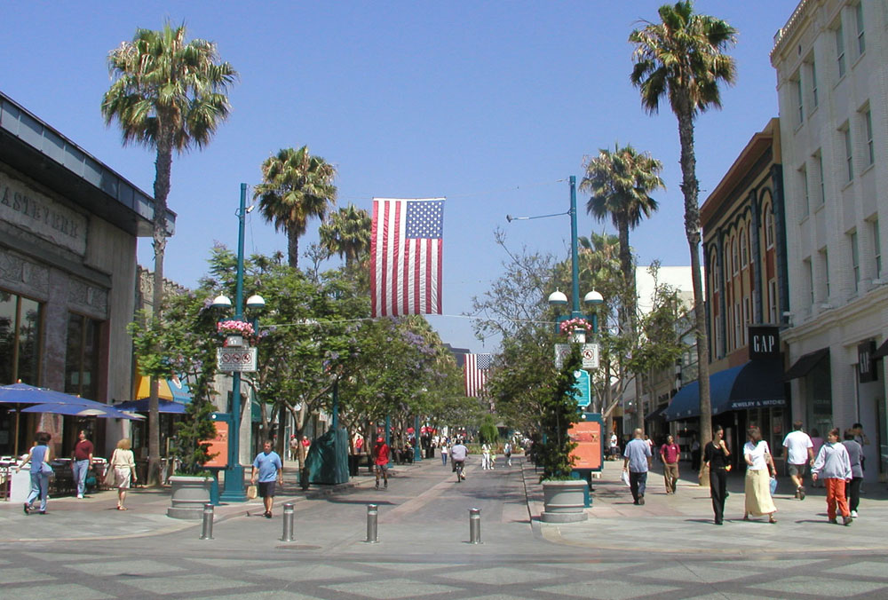
Although food trucks and food carts have long been a staple of Portland culture, following the economic downturn in fall 2008, a vibrant street food scene began really taking hold in Portland, Oregon. While popular culture – from food shows on cable television to movie stars like Brad Pitt supporting sustainable and local food choices – had a big roll in this development, the key element was the City of Portland’s relatively lenient mobile food vending regulations, low permit fees and provision of technical assistance to entrepreneurs. There are currently between 450 and 500 food carts operating in Portland – an increase of approximately 40% in the last 2 years.

Food trucks, Portland, OR Source: MIG

The carts are set up in parking lots, vacant lots, sidewalks, and even in parks. Many of the carts are located near downtown. Although food carts might be located singly, they can often be found in large groups called a pod. They have limited hours, little to no seating, and their menus are typically minimal. Therefore, they do not compete with traditional restaurants. Sometimes a chef will use a food cart to introduce, develop, or refine recipes to be used in a separate brick-and-mortar restaurant. This type of food cart outreach also allows customers to taste test menu items without the expense of time and tip involved in trying a full-service restaurant. Food carts complement brick-and-mortar restaurants, providing another level of food experience and attracting spenders to other retail or restaurants nearby.

 Food carts, Portland, OR Source: MIG

Food cart support and regulation comes from a number of agencies, including the Portland Bureau of Transportation (when located within the right-of-way), the City of Portland Bureau of Development Services, Multnomah County Health Department and Portland Fire and Rescue.

Other independent groups study and promote Portland’s food carts, including the Urban Vitality Group and CARTopia (Rodgers and Roy 2010). The Urban Vitality Group is a group of Portland State University graduate students who partnered with the City of Portland’s Bureau of Planning to study the effects of food carts on street vitality and livability. CARTopia, written by Kelley Roy and Kelly Rodgers, documents Portland’s food cart revolution. Both the Urban Vitality Group and CARTopia indicate that food carts foster social interaction and walkability in the public realm, provide interim uses for vacant lots, and create opportunities for individuals to establish their own businesses with minimal capital.

Other cities are now following Portland’s lead. Seattle is considering the removal of vending prohibitions to encourage mobile food vending on public right-of-ways and underutilized lots. Boston has offered mobile food vending workshops and hosted a Food Truck Challenge to select mobile food vendors for Boston’s City Hall Plaza. Other areas like Los Angeles, the San Francisco Bay Area and New York City all have popular street food scenes. Food trucks can also be found in cities across the country, including Denver, Dallas, St. Louis, Chicago, Minneapolis and Atlanta.

There are several key elements in place that guide Portland’s mobile food carts:

  1. Public realm food cart regulations:
    • Food carts are only allowed within commercial zones.
    • Carts must not block pedestrian traffic on sidewalks.
    • Only one vending cart is allowed for an operating area (an “operating area” is the sidewalk from the midpoint of one block face to the midpoint of an adjacent block face).
    • A vendor’s immediate operating area cannot exceed 24 square feet of the sidewalk.
    • The vendor is responsible for all litter and garbage within 25 feet of the business.
    • Vending carts may not remain on the sidewalk between midnight and 6:00 a.m.
  2. Private realm food cart regulations (often clustered in pods):
    • Carts 16 feet long or less and on wheels: Considered utility trailers; no permit is required for cart itself.
    • Carts longer than 16 feet on wheels: Considered a heavy truck; not allowed in some zones.
    • Any cart without wheels: Zoning regulations apply and building permits are required.
  3. All food carts are required to operate under the same health and safety guidelines as restaurants and to receive inspections twice a year.

In addition, the Urban Vitality Group’s report makes a few additional key recommendations:

  1. Promote innovative street design elements that support food carts, such as seating, shelter, landscaping, and pedestrian-friendly sidewalks.
  2. Ensure an adequate supply of trash cans near food trucks.
  3. Sponsor a design competition to incorporate food cart uses on sites.
  4. Continue to support diversity in design regulations.
  5. Identify additional locations for food carts.
  6. Increase awareness of informational resources and connect micro-entrepreneurs with existing programs, such as Mercycorp NW, Hacienda CDC, Hispanic Chamber of Commerce, Portland Development Commission, and VOZ Day Labor Center.

Although there is no revenue for the City of Portland unless the food cart grosses more than $50,000 a year, the city benefits from revitalized urban spaces, neighborhood vitality, increased tourism and developing entrepreneurs. For Portland, the presence of food carts has helped activate previously vacant parcels of land, minimizing gaps in the social fabric, which like weak points in a piece of cloth can sometimes tear apart a strong and vibrant commercial area. Mobile food vending has also helped encourage pedestrian use of streets, and it has helped promote social interaction in the public realm. Together these elements create a scene that is attractive to visitors far and wide and helps encourage tourism. Food vending carts have also increased opportunities for lower income individuals, which has helped buoy the community against the lagging national economy.

Lessons Learned
Potential Benefits:

  • Revitalizes urban spaces and strengthens neighborhood vitality.
  • Helps activate previously vacant parcels of land and dead sidewalks, minimizing gaps in the social fabric.
  • Encourages pedestrian use of streets and promote social interaction in the public realm.
  • Helps encourage tourism.
  • Develops entrepreneurs.
  • Increases economic opportunities for lower income individuals, which has helped buoy the community against the lagging national economy.

Potential Issues:

  • Permanent location: Ensure food carts can maintain a mobile business status, while also providing a somewhat permanent location.
  • Waste disposal and wastewater: Waste disposal and wastewater are two key issues that need to be addressed and regulated.
  • Key elements in promoting mobile food vending: Looser regulations, lower permit fees and the provision of technical assistance are key aids in helping to promote mobile food vending.

Food Cart Vendors, Cesar Chavez Street, Los Angeles, CA

Background

 Street view, East Cesar Chavez Avenue, Source: Google Street View 2011

East Cesar Chavez Avenue between I-10 and Evergreen Avenue is commonly considered to be the Main Street of the Boyle Heights neighborhood in East Los Angeles. Considered to be one of the first suburbs of Los Angeles, Boyle Heights is a neighborhood east of Downtown Los Angeles. For much of the twentieth century, Boyle Heights was a gateway for new immigrants. This resulted in diverse demographics, including Jewish American, Japanese American and Mexican American populations, as well as Russian American and Yugoslav populations. Today the neighborhood is populated mostly by working class Latinos.

 East Cesar Chavez Avenue, Source: MIG

From its very beginnings, Cesar Chavez Avenue has served as the commercial and social heart of this suburban neighborhood of Los Angeles.The corridor bursts with activity and life. In addition to the continuous edge of general stores, markets, restaurants and locally serving businesses, the street has a rich and diverse range of street vendors and mariachis that make the streetscape seem like a lively open market – a place where people like to congregate, buy and sell things. Despite the fact that the existing sidewalks and street elements, such as trees, lighting and seating do not appropriately serve the pedestrians and formal and informal community uses, the street is much loved by the community and a great source of commerce.

 Street venders, Source: MIG

The organic evolution of the street and the various commercial uses serves as a great example of how the street ROW of an arterial road can be maximized for formal and informal retail opportunities, and provide much needed entrepreneurial jobs for the people who live and work in the area. This also helps maintain the affordable character of the neighborhood that is critical to its residents.

 Active street, Source: MIG

The right-of-way of Cesar Chavez is 80 feet wide. Designated as a major arterial road, the street has two lanes of traffic in either direction and serves a high volume of through and destination traffic every day. On-street parking on either side of the roadway provides a much needed amenity to adjoining businesses. The sidewalks are approximately 12 feet wide on both ends of the street. Most people in the area do not own cars. Besides carrying heavy foot traffic, the sidewalks are actively used for a wide variety of commercial activities such as:

  • Outdoor dining for adjoining cafes and restaurants.
  • Outdoor display space for adjoining land uses that sell garments, produce, electronics, etc.
  • Mobile food carts that cook and serve freshly made food and drinks.
  • Mobile retail carts that serve flowers, books, audio devices, etc.
  • Performance spaces for musicians, especially mariachis.

In addition, the parking lane is used by taco trucks and other vendors to sell various items. The corridor is also well served by transit, including local and express buses. Some transit stops have been customized to reflect the community history and culture.

Although the right-of-way is quite constrained, the corridor carries a fair amount of regional and destination traffic while still serving as a great place for commercial activities. Besides serving the adjoining formal land uses, the street and the sidewalk environment has continuously evolved to meeting the changing demographics and needs of the community users. Its stable and continuously evolving commercial environment has helped attract individuals and businesses.

Lessons Learned
Potential Benefits:

  • Includes a variety of formal and informal retail opportunities that also provide much needed entrepreneurial jobs for the people who live and work in the area.
  • Creates a vibrant street that maintains the affordable character of its surrounding neighborhood within a constrained right-of-way.
  • Uses informal sidewalk design to accommodate continuously changing commercial uses that reflect the changing sociological, religious and economic context of the street. The commercial sidewalk uses reflect the changing needs of the people.
  • Uses 10-foot wide travel lanes to ensure that automobiles respect the overarching pedestrian scale and character of the street.

Potential Issues:

  • High maintenance: The high foot traffic and heavy commercial use results in continuous repair and disrepair of the street. Few trees are able to survive in this context to provide necessary shade and comfort to the users.
  • Constrained space: Maximizing commercial uses on the street results in constrained space for pedestrians and people in wheelchairs.
  • Other uses: There is a lack of pedestrian amenities, especially in terms of seating, lighting, etc. In some ways, the success of the commercial activities on the streets has negatively affected other supporting users of the streets.

The City is considering the redesign of Cesar Chavez to truly reflect its main street status. Widened sidewalks, flexible parking areas, continuous street trees and corner bulbouts will physically reinforce, organize and provide safe and desirable environments for the spontaneous activities that already take place on a daily basis.

Sources

Ferretti, Elena, May 10, 2011. “Portland”s Gourmet Food Cart Phenomenon” FoxNews.com (http://www.foxnews.com/leisure/2011/05/10/portlands-gourmet-food-cart-phenomenon/)

Oregon Business, January 2010. “Portland Food Carts Push Through Recession”

Rodgers, Kelly and Roy, Kelley, 2010. “CARTopia: Portland’s Foodcart Revolution”

Urban Vitality Group, 2008. “Food Cartology: Rethinking Urban Space as People Places”

Interview with Jenn Bildersee, City of Portland, Bureau of Environmental Services

Interview with Jay Renkens, Director of Urban Planning Services, MIG Portland

The Los Angeles Times. “Boyle Heights Los Angeles Times Neighborhood Project” (http://projects.latimes.com/mapping-la/neighborhoods/neighborhood/boyle-heights/)

Photo Sources

MIG, Inc.

Pages

Subscribe to RSS - beautify streetscape